


JEFFERSON Voting District, Stephenson County, Illinois
About
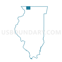
Outline

Summary
| Unique Area Identifier | 574776 |
| Name | JEFFERSON Voting District |
| County | Stephenson County |
| State | Illinois |
| Area (square miles) | 18.26 |
| Land Area (square miles) | 18.26 |
| Water Area (square miles) | 0.00 |
| % of Land Area | 100.00 |
| % of Water Area | 0.00 |
| Latitude of the Internal Point | 42.24014640 |
| Longtitude of the Internal Point | -89.89081490 |
Maps


Graphs
Select a template below for downloading or customizing gragh for JEFFERSON Voting District, Stephenson County, Illinois


Neighbors
Neighoring Voting District (by Name) Neighboring Voting District on the Map
- BERREMAN Voting District, Jo Daviess County, IL
- CHERRY GROVE/SHANNON 1 Voting District, Carroll County, IL
- FREEDOM Voting District, Carroll County, IL
- KENT Voting District, Stephenson County, IL
- LORAN Voting District, Stephenson County, IL
- WARDS GROVE Voting District, Jo Daviess County, IL
Top 10 Neighboring County Subdivision (by Population) Neighboring County Subdivision on the Map
- Cherry Grove-Shannon township, Carroll County, IL (1,485)
- Loran township, Stephenson County, IL (1,442)
- Kent township, Stephenson County, IL (702)
- Freedom township, Carroll County, IL (695)
- Jefferson township, Stephenson County, IL (268)
- Wards Grove township, Jo Daviess County, IL (224)
- Berreman township, Jo Daviess County, IL (147)
Top 10 Neighboring Unified School District (by Population) Neighboring Unified School District on the Map
- Eastland Community Unit School District 308, IL (4,268)
- Stockton Community Unit School District 206, IL (3,901)
- Pearl City Community Unit School District 200, IL (2,690)
Top 10 Neighboring State Legislative District Lower Chamber (by Population) Neighboring State Legislative District Lower Chamber on the Map
Top 10 Neighboring State Legislative District Upper Chamber (by Population) Neighboring State Legislative District Upper Chamber on the Map
Top 10 Neighboring 111th Congressional District (by Population) Neighboring 111th Congressional District on the Map
Top 10 Neighboring Census Tract (by Population) Neighboring Census Tract on the Map
- Census Tract 9601, Carroll County, IL (3,578)
- Census Tract 205, Jo Daviess County, IL (3,244)
- Census Tract 4, Stephenson County, IL (3,008)
- Census Tract 9602, Carroll County, IL (2,165)